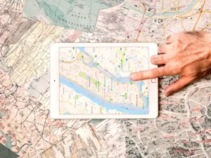
Maps Digitization and Raster-to-Vector Conversion
Our digitization services convert paper maps and raster images
into editable vector formats for digital use.

Our digitization services convert paper maps and raster images
into editable vector formats for digital use.

We provide experienced and well-equipped survey
crews for projects of varying scopes.

Traverse’s survey consultancy and engineering check
services offer clients expert guidance throughout
project planning
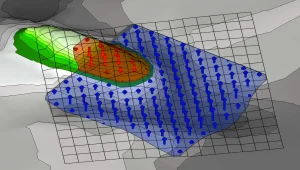
Calculating earthworks volumes is essential for
construction budgeting, as it determines the
amount of soil
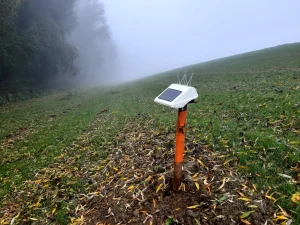
Settlement monitoring involves tracking structural
movement and foundation shifts over time
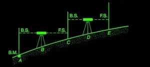
Establishing control
stations and benchmarks
provides reliable reference
points essential for
maintaining surveWe offer precise