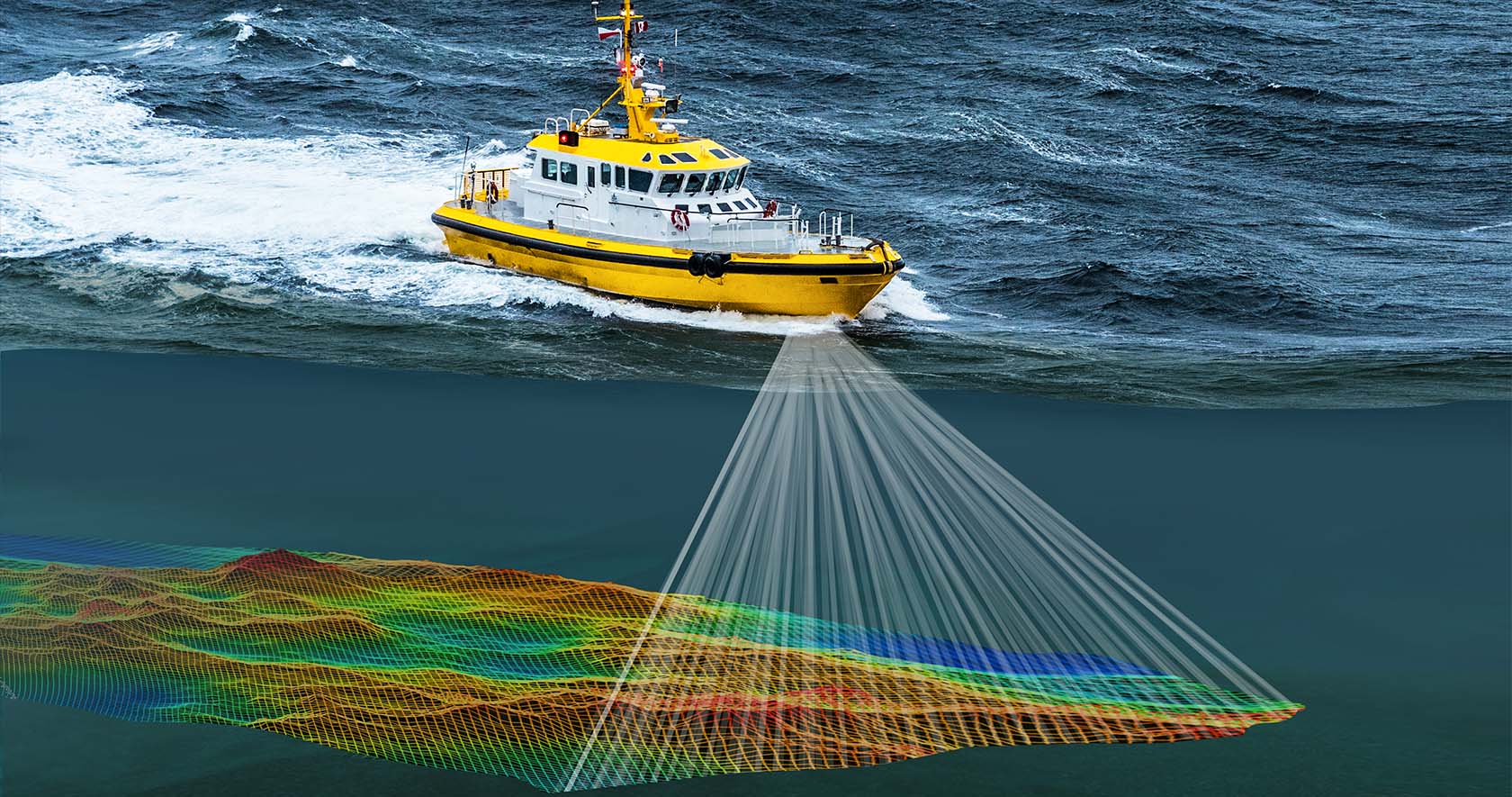
Specializing in near-shore bathymetric surveys, we accurately
map underwater topography close to shorelines. This data is
vital for projects that involve marine construction or coastal
development, as it allows engineers to assess underwater
features, manage construction risks, and make decisions
that account for environmental and navigational safety
considerations.